01
ACQUIRE
Bring sources into a registered workspace
WFS, WCS, STAC, authorized APIs, archives and local files enter with source IDs, checksums, licenses and acquisition metadata.
OUTPUTSource ledger + immutable originalsPROJECT-PROVEN
 DOCUMENTS ↗
GEORIN / GEOSPATIAL DATA GOVERNANCE
A local-first path for acquiring, cleaning, storing and publishing multi-source geospatial data — built around real industry workflows and evidence you can inspect.
Historical project evidence — not a live connection to your data.
CHOOSE YOUR PATH
Learn what vectors, rasters, CRS and OGC services mean in plain language.
Build a mental model → 02See which files and workflows are supported, and where governance adds value.
Inspect the workflow → 03Compare project evidence, current product capabilities and explicit execution limits.
Check the boundaries →THE GOVERNED LIFECYCLE
Data governance is more than converting formats. It preserves where data came from, what changed, what passed validation and how it was published.
WFS, WCS, STAC, authorized APIs, archives and local files enter with source IDs, checksums, licenses and acquisition metadata.
Normalize coordinate reference systems, repair geometry, deduplicate records, align fields and apply quality rules without hiding exceptions.
Load governed outputs into PostGIS and compare counts, geometry hashes and schema consistency between file and database copies.
Publish OGC services for maps and analysis. Separate service availability from data authorization, and preserve evidence with each release.
WHAT CAN IT GOVERN?
Each data family needs different checks. These are the formats and entities handled in the project-proven workflows.
The current Documents upload accepts only single-page JPG, PNG and TIFF. Geospatial ETL is not yet exposed as a desktop upload workflow.
ENTITY INDUSTRIES / REAL EVIDENCE
These figures are preserved project outputs, not synthetic dashboard illustrations. Each industry has a different endpoint and a different evidence status.
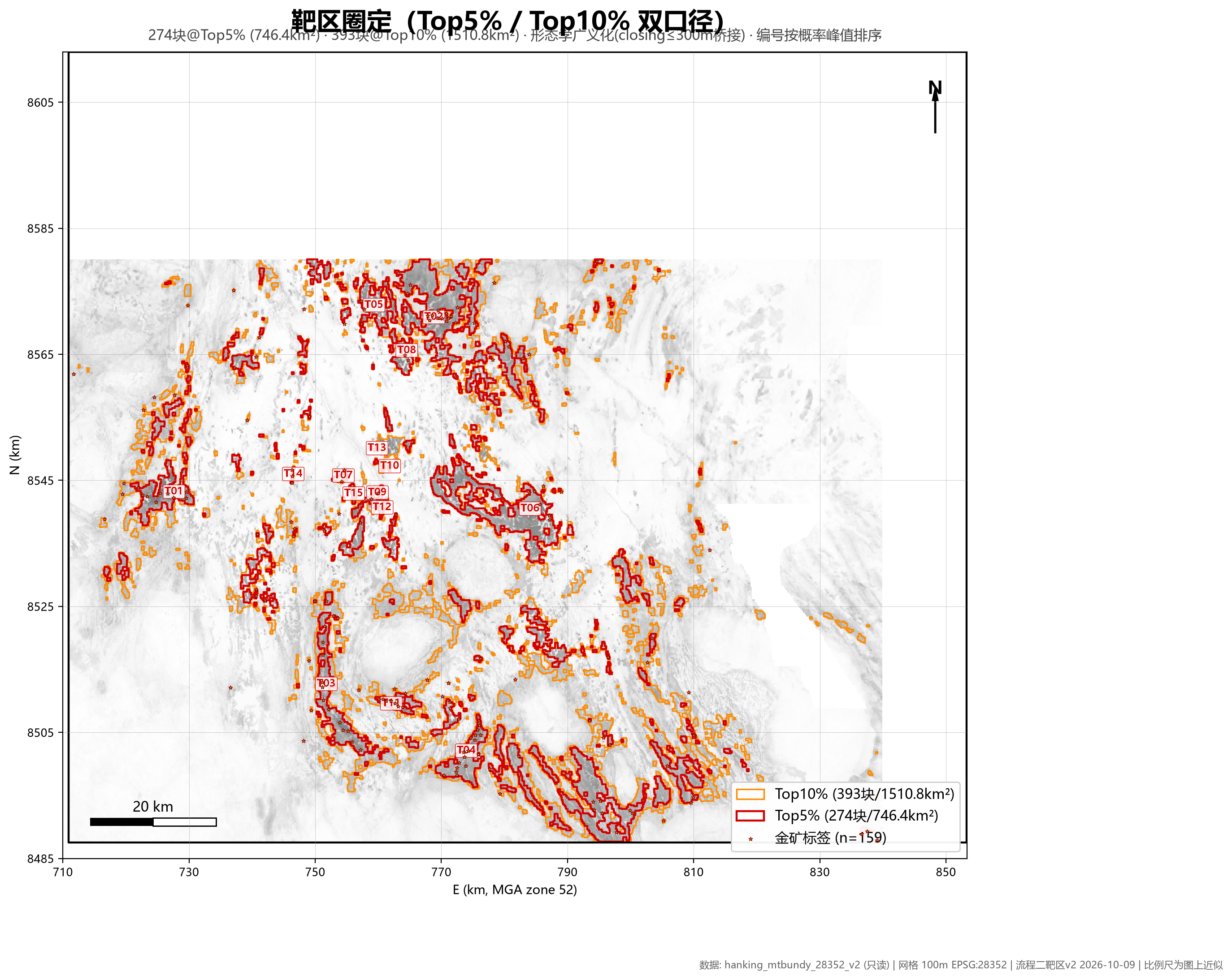
Geology, drillholes, geochemistry, gravity, magnetics and radiometrics are normalized, reconciled and carried through WofE/RF evidence workflows.
Target ranking supports research; it does not replace geological or investment decisions.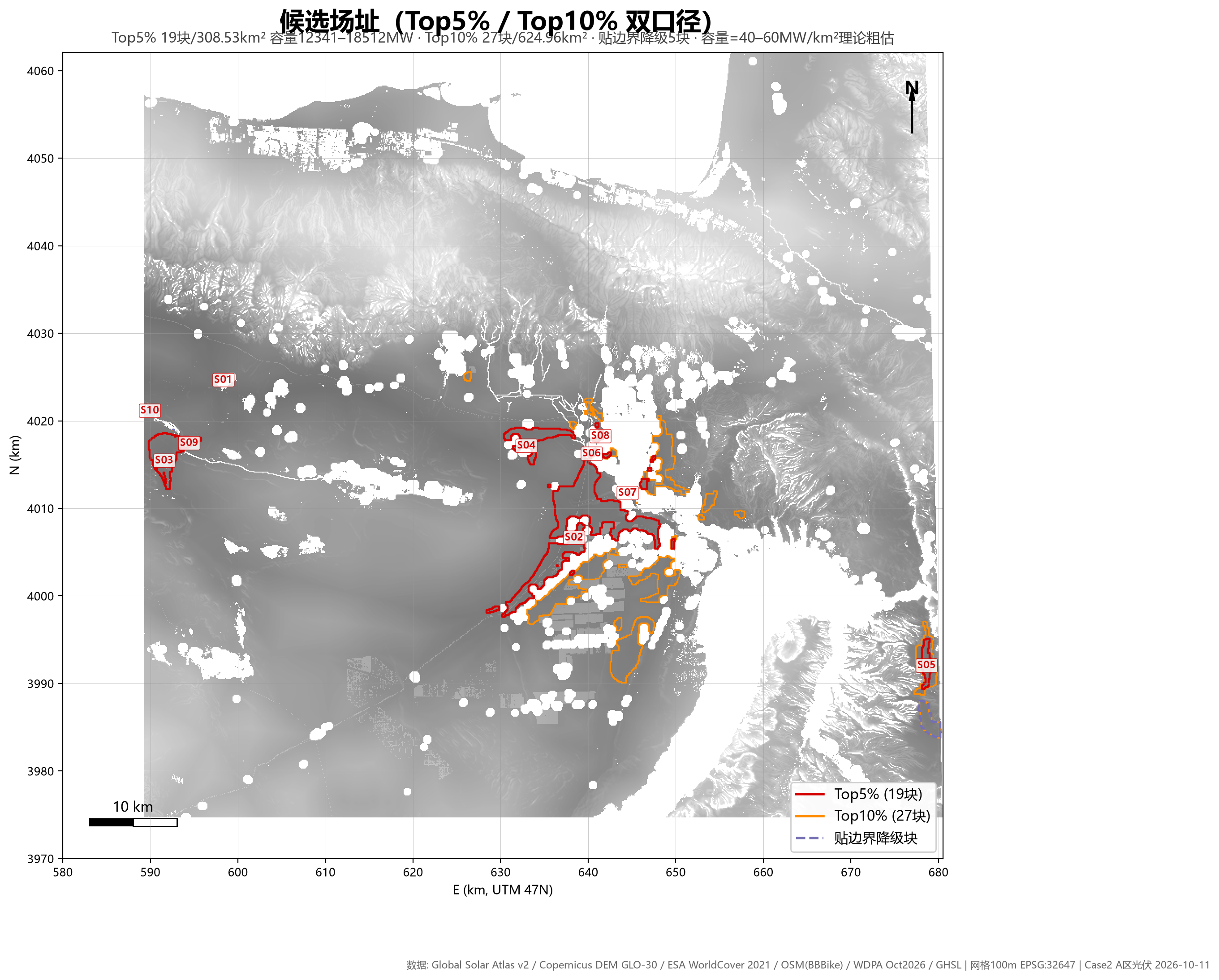
Terrain, resource and constraint layers feed a reproducible suitability model and map-based site summaries.
Analysis and file delivery are proven; PostGIS/OGC publication is not claimed for this case.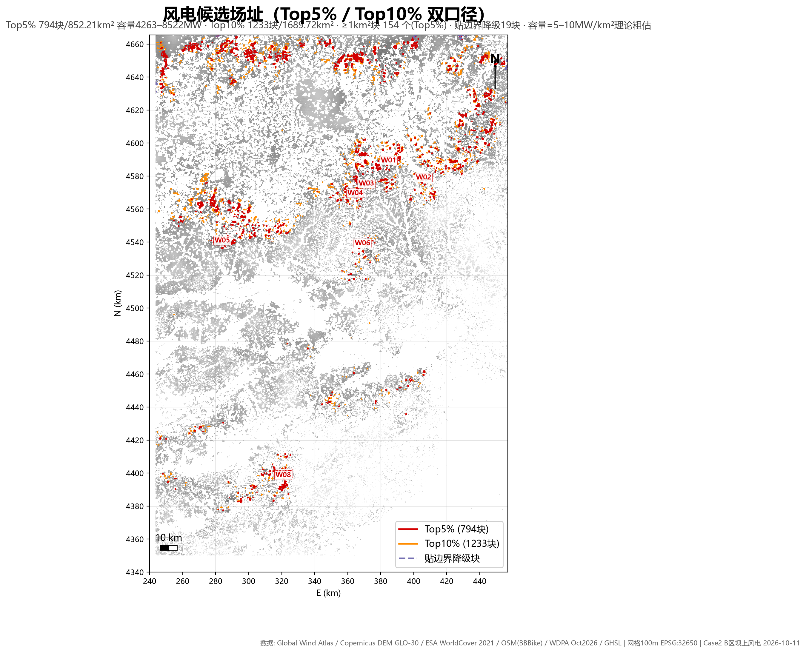
A separate evidence chain applies wind-resource and terrain rules while preserving model lineage and outputs.
Analysis and file delivery are proven; PostGIS/OGC publication is not claimed for this case.CLEAR STATUS, NO OVERCLAIMING
GEORIN distinguishes project evidence from product functionality. This makes the roadmap visible without disguising it as a finished feature.
EXECUTION BOUNDARIES
A trustworthy tool explains what it will not do before it asks for your data.
Originals are treated as read-only. Cleaning creates governed derivatives instead of silently overwriting your files.
Remote acquisition must use authorized sources and explicit credentials. The system does not bypass access controls.
Public and desktop delivery links support online preview. ZIP, source PDF and export endpoints remain disabled by policy.
Models prioritize evidence and candidates. They do not replace expert review, engineering decisions or investment judgment.
Online preview cannot prevent external screenshots or photography. Current Documents sources and deliveries expire after 24 hours by default; geospatial retention follows its separate project policy.
A FIVE-MINUTE FOUNDATION
You do not need a GIS degree to understand the governance path. Open each term for a practical explanation.
Vector data stores points, lines and polygons such as drillholes, roads and licence areas. Raster data stores cells, such as elevation, imagery and gravity grids. Governance checks them differently.
A coordinate reference system tells coordinates where they belong on Earth. Layers with mismatched or missing CRS information can appear in the wrong place, so CRS checks come before analysis.
PostGIS adds spatial storage and queries to PostgreSQL. Instead of passing folders of files between tools, a project can query governed layers from one reconciled data core.
They are standard OGC service interfaces. WMS serves map images, WFS serves feature data and WMTS serves map tiles. Publishing a service does not automatically make it public or anonymous.
A traceable result keeps its original source, acquisition time, transformations, validation results and release identifiers. That evidence lets another person reproduce or challenge the result.